
Published
From Makimuku at the foot of Mt Miwa, by way of Iware, to Asuka: the seat of royal power moved south across a distance of about ten kilometres.
In the north of Sakurai City, at the north-western foot of Mt Miwa, lies the Makimuku Site. It is the remains of a large settlement occupied from the early 3rd century to the early 4th century.
What makes it special is the pottery found there. Tōkai, Hokuriku, San'in, Kibi, Kantō: pottery brought from all these regions makes up more than a tenth of the total. People and goods were gathering here from far away.
It is also known that hardly any farming tools have been found. It is thought to have been a place built not for working rice fields but for politics and ritual.
In 2009 the remains of large buildings were found. The biggest of the buildings lined up east to west had a floor area of about 238 square metres, among the largest known from the same period.

At the southern end of the site is the Hashihaka Kofun (kofun: ancient burial mound). It is about 280 m long. It is one of the very earliest keyhole-shaped tombs of the standardised type, and is thought to have been built between the middle and the latter part of the 3rd century.

Whether this site was Yamatai, the kingdom described in Chinese records, is still unsettled. But it is widely accepted that the early centre of the Yamato kingship (the early Japanese state) was here.
Just south of Makimuku stands Mt Miwa.
Ōmiwa Shrine, which worships the mountain itself as a god, has no main sanctuary. Behind its worship hall stands the Mitsu-torii, a triple torii gateway, and beyond that is the mountain. It is said to preserve a form of worship older than building shrines to receive the gods.

The Nihon Shoki (Japan's oldest official chronicle, compiled in 720) relates that in the reign of Emperor Sujin an epidemic swept the land, and it finally subsided only when the god Ōmononushi was worshipped. This mountain is where that god dwells.
The centre of royal power and the mountain of the god sat side by side.
From the 4th to the 5th century, the story stops being simple.
The great kings' tombs came to be built at Saki in the north of the Nara basin, and later on the plains of Kawachi and Izumi. Giant kofun, including the Daisen Kofun identified as the tomb of Emperor Nintoku, lined the plains near the sea.
Meanwhile, the palace names recorded in the Kojiki (Records of Ancient Matters, 712) and the Nihon Shoki are scattered all over Yamato. Tombs and palaces were not necessarily in the same place.
Among them, one place name comes up again and again: Iware.
Iware is the area from what is now south-western Sakurai City to eastern Kashihara City, about five kilometres south of Makimuku.
Emperor Richū's Iware no Wakazakura no Miya. Emperor Seinei's Iware no Mikakuri no Miya. Emperor Keitai's Iware no Tamaho no Miya. Emperor Yōmei's Iware no Ikenobe no Namitsuki no Miya.
That means the palaces of four reigns were placed here between the 5th and 6th centuries.
The name of Emperor Jinmu, Kamuyamato Iwarebiko no Mikoto, also contains this place name.

Among the Iware palaces, Emperor Keitai's Tamaho Palace has a special story.
Keitai was a great king brought in from Echizen. He took the throne in 507 at the Kusuha Palace (Hirakata, Osaka Prefecture), moved to the Tsutsuki Palace (Kyōtanabe, Kyoto Prefecture) and then the Otokuni Palace (Nagaokakyō, Kyoto Prefecture), and only entered Iware in Yamato in 526, almost twenty years after his accession.
Why did he not enter Yamato at once? One view is that there were forces on the receiving side that would not come to terms with him, but nothing is known for certain.
Put the other way round, placing a palace at Iware meant having taken control of Yamato.
The word "Ikenobe" in the name of Emperor Yōmei's palace means "by the pond", that is, by Iware Pond.
This pond was remembered through a poem.
Momozutau Iware no ike ni naku kamo o kyō nomi mite ya kumogakurinamu (Man'yōshū, Book 3, No. 416) — "The ducks crying on the pond of Iware: am I to see them only today, and then vanish into the clouds?"
The poem is attributed to Prince Ōtsu, who was arrested on suspicion of treason and ordered to take his own life in 686. Its meaning is: is today the last time I will see the ducks crying on the pond? "Momozutau" is a makurakotoba, a fixed poetic epithet attached to Iware. (The Man'yōshū is Japan's oldest anthology of poetry.)
For a long time no one knew where the pond had been, but in 2011 the remains of a large embankment were found in Kibi, Sakurai City. It is thought that they may belong to Iware Pond.
Emperor Yōmei died in 587. The next ruler, Emperor Sushun, set up his palace at Kurahashi no Shibagaki no Miya, in Kurahashi, Sakurai City, east of Iware at the foot of Tōnomine.
After Sushun was assassinated in 592, Empress Suiko took the throne and moved into the Toyura Palace, in Toyura, Asuka Village. Here began Asuka's hundred years.
From Iware to Asuka is about five kilometres to the south.

There is no single reason why palaces moved. There was a custom of building a new palace for each reign, and the palace kept moving even after it came to Asuka.
Beyond that, there are several views about the broad drift from Makimuku to Iware and then Asuka.
One is the lie of the land. Makimuku, Iware and Asuka all sit on the eastern and southern edges of the Nara basin, in valleys where the hills come close and water is easy to obtain.
Another is the clans. From the latter half of the 6th century, the Soga clan was based in Asuka. In this view, the power of the Soga, handed down from Iname to Umako, drew the palace to Asuka.
Roads mattered too. Both Iware and Asuka lie on routes leading to Hase and to Naniwa (present-day Osaka).
Where the centre of Iware lay has still not been settled. No palace remains have been found either.
Even so, by a roadside in Yamada, Sakurai City, stands a stone marker inscribed "Iware-michi". Just to the south is the Yamada-dera Temple Site.
The Makimuku Site and Ōmiwa Shrine are within walking distance of Makimuku Station and Miwa Station respectively on the JR Man'yō-Mahoroba Line (Sakurai Line). They lie north of Asuka, along the same edge of the basin.
RELATED SPOT
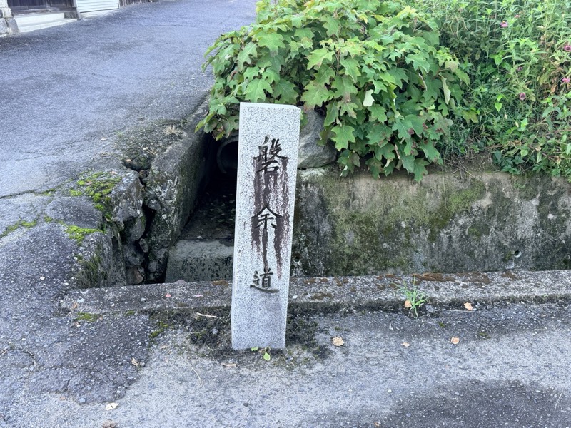
磐余道碑
A stone marker carved with the words "Iware Road," in the hand of the novelist Inoue Yasushi.
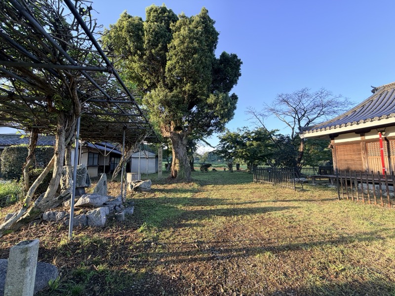
山田寺跡
A temple site where a corridor was excavated just as it had collapsed and been buried.
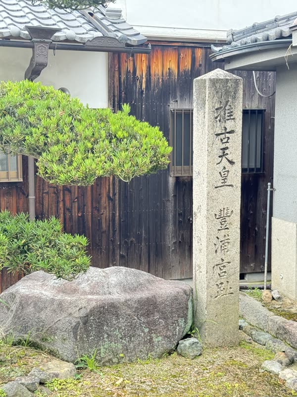
豊浦宮跡
The site of the palace where Empress Suiko took the throne, marking the beginning of the Asuka period.
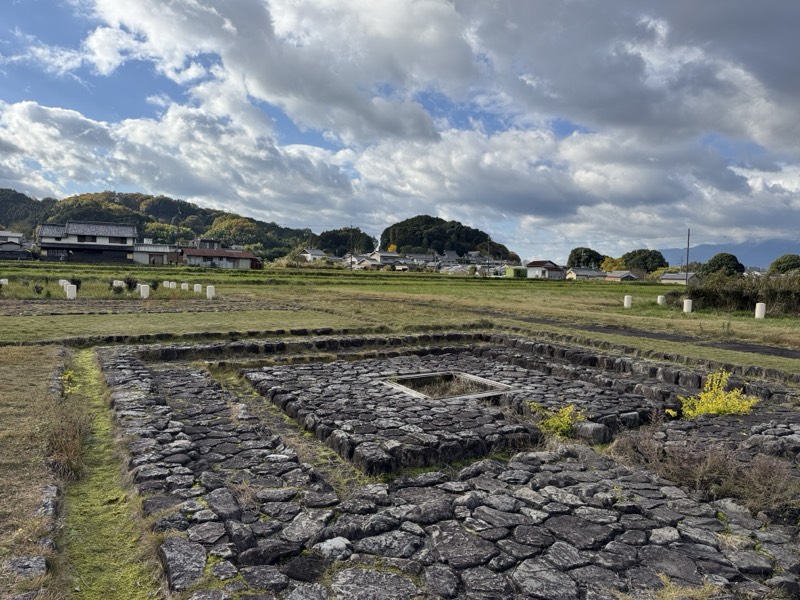
飛鳥宮跡(伝 飛鳥板蓋宮跡)
The political heart of Asuka, where several palaces were built one on top of another.
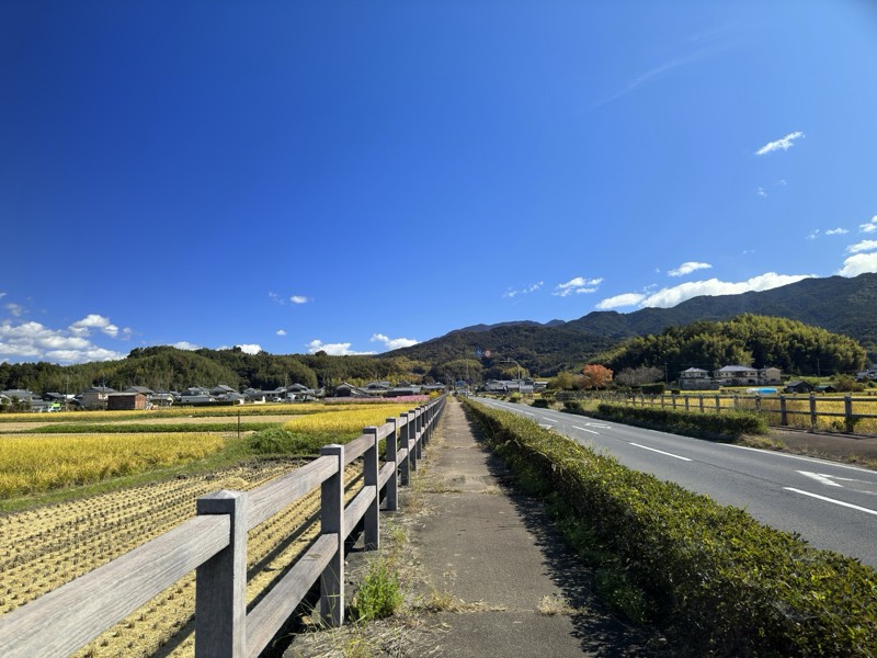
山田道
An ancient official road running east–west through Asuka. It welcomed envoys from Sui China and led to Yamada-dera Temple.
RELATED COLUMN
 No Longer from Brother to Brother: Succession through the Direct LineIn ancient Japan the throne often passed from elder brother to younger. One attempt to draw a line from…Why did the palaces of Asuka keep moving?Toyura, Oharida, Okamoto, Itabuki, Kawahara, Kiyomihara. Over a hundred years the palace moved again and…After the Oath: What Became of Emperor Tenmu's PrincesIn 679 Emperor Tenmu made six princes swear at Yoshino never to fight one another. It is well known that the…